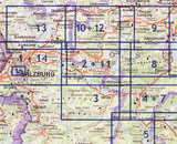
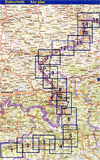
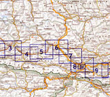
Cycling and Leisure Maps of Austria
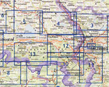
Series of cycling maps in scales 1:125,000 and 1:100,000. Every map fits into every standard handlebar bag. Additional to the representation and short description of the routing, interesting information and addresses are contained. For practical usage a special folding system has been developed. Just follow the arrows, this will take you to the next sheet according the consecutive number. When you have reached the last sheet, just completely unfold the whole map. Then simply fold it up along its longitudinal side. Text is in German and English languages.
RK 1 Danube Bike Trail - Donauradweg
Cycling map is composed of 17 sheets.
Elevation profile: Start - Passau (315 m), destination - Bratislava(125 m).
Whole lenght of bike-trail: 380 km.
Routing leads through flat territory and always along cycle tracks.
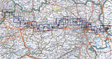
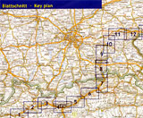
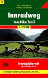
RK 2 Inn Bike Trail Landeck - Passau
Cycling map is composed of 16 sheets.
Elevation profile: Start - Landeck (790 m), destination - Passau (300 m).
Whole lenght of bike-trail: 390 km.
Routing leads through flat territory, for the greater part along waterside cycle tracks, in part on ballast.
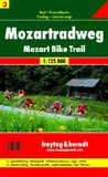
RK 3 Mozart Bike Trail in Salzburg Surroundings
Cycling map is composed of 13 sheets.
Elevation profile: Start - Salzburg/Itzling (415 m), destination - Salzburg (415 m).
Whole lenght of bike-trail: 385 km.
For the greater part, routing leads through flat territory, mainly along cycle tracks or lightly trafficked roads.
RK 4 Salzkammergut Bike Trail
Cycling map is composed of 16 sheets.
Elevation profile: Start - Salzburg/Itzling (415 m), destination Salzburg/Itzling (415 m).
Whole lenght of bike-trail: 353 km.
Routing. Few activities, mainly along cycle tracks or lightly trafficked roads.
RK 5 Tauern Bike Trail
Cycling map is composed of 15 sheets.
Elevation profile: Start - Krimml (1067 m), destination - Passau (294 m).
Whole lenght of bike-trail: 304,8 km.
For the greater part, routing leads through flat territory, mainly along cycle tracks or lightly trafficked roads.
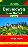
RK 6 Drava Bike Trail
Cycling map is composed of 16 sheets.
Elevation profile: Start - Toblach/Dobbiaco (1241 m), destination - Maribor/Marburg (1260 m).
Whole lenght of bike-trail: 352 km.
For the greater part, routing leads through flat territory, mainly along cycle tracks or lightly trafficked roads, last stage to Maribor partly on busy roads or ballast.
List of Cycling and Leisure Maps of Austria
RK 7 Ennsradweg 1:125 000
RK 8 Murradweg 1:125 000
RK 9 Kamp · Thaya · March Radweg 1:125 000
RK 10 Bodenseeradweg 1:75 000
RK 100 Vorarlberg 1:100 000
RK 101 Mostviertel 1:100 000
RK 103 Weinviertel 1:100 000
RK 104 Burgenland Nord 1:100 000
RK 105 Steiermark Südost · Burgenland Süd 1:100 000
RK 106 Kärntner Seenland 1:100 000
More information:
Maps of Austria for Hiking, Cycling and Leisure Time
Austria - Road + Leisure Time Maps
Published: 2008-05-08
Updated: 2008-05-08
Categories: Trips, walks - Cycling