Cycling Maps of Slovakia
Najkrajsie cyklisticke okruhy, juhozapad
Vydavatelstvo Dajama vydalo v roku 2012 publikaciu Najkrajsie cyklisticke okruhy, juhozapad.
Autori, Daniel Kollar, Frantisek Turansky, v tomto druhom titule z novej edicie Po Slovensku Cyklotrasy – juhozapad popisuju na 208 stranach 33 cykloturistickych tras po juhozapadnom Slovensku, tipy a zaujimavosti na trasach a prinasaju viac ako 200 farebnych fotografii, profily tras, casove rozvrhy s prevyseniami a mapove vyrezy so zakreslenymi trasami. Sucastou knihy bude aj samostatna mapa znackovanych cyklistickych tras.
Cycling maps of Slovakia
The edition contains old cycling maps which are outdated. Good for general overview only.
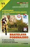
Maps of Slovakia in scale 1 : 100,000. Consist of maps and little textbooks (128 x 194 mm), both are in covering case.
There are:
Legends in five languages (Slovak, German, English, Hungarian or Polish)
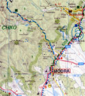
Marked or recommended routes, description of routes (length of the route, gradient).
Kysuce, Turiec, Horne Povazie
Orava, Liptov, Horehronie
Tatry, Spis, Zamagurie
Saris, Horny Zemplin
Kosice, Dolny Zemplin
Zahorie, Povazie
Bratislava, Podunajsko
Pohronie
Gemer, Novohrad, Podpolanie
More information:
 Cycling Maps - Bratislava and Surroundings
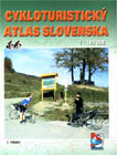
Cycling Atlas of Slovakia 1:100000
The Cycling atlas of the Slovak republic includes map of Slovakia in a scale 1:100000, map sheet, legend and register. There is a list of cycling routes including description. Text is in Slovak language.
<%cyklistika(lang)%>
More information:
Cykloturisticky atlas Slovenska 1:100000 (Cycling Atlas of Slovakia)
Published: 2005-06-07
Updated: 2005-06-07
Categories: - Cycling


